


SEJournal Online is the digital news magazine of the Society of Environmental Journalists. Learn more about SEJournal Online, including submission, subscription and advertising information.
May 13, 2026
 |
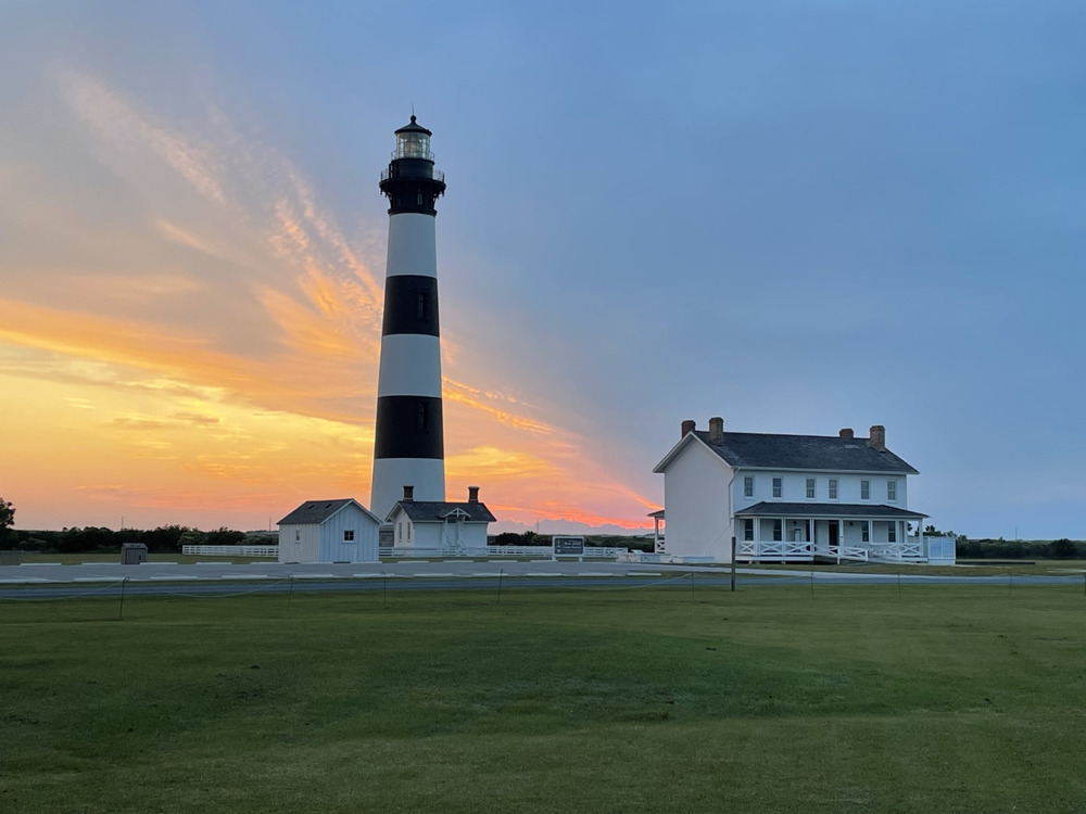 |
| Sunrise at the Bodie Island Lighthouse at Cape Hatteras National Seashore. Photo: Public Domain. |
TipSheet: National Seashores Are a Secret Summer Treasure
By Joseph A. Davis
If national parks are “America’s best idea,” then our national seashores may be America’s best-kept secret. For summer getaways, they are a treasure. Don’t tell. Or actually, since we’re environmental journalists, do.
There are more of them than you might imagine. Officially, 10. But other coastal and lake playgrounds supplement them. Some can be reached by public transit; some can be reached by RV. Some you have to hike or paddle to.
To begin the story at (near) the beginning, we could point to what is now the Boundary Waters Canoe Area, carved out of the Superior National Forest in Northern Minnesota. On its northern boundary is the Quetico Provincial Park of Ontario.
Canoeists and fishers are enchanted by its thousands of pristine lakes. You can swim naked and have walleye for dinner. Watch for bears. It’s not really a national park, but was first made a roadless area in 1930, then a federally designated wilderness in 1964.
Technically, the first official national
seashore was Cape Hatteras,
established in 1937.
Technically, the first official national seashore was Cape Hatteras National Seashore, established in 1937. Built by the Civilian Conservation Corps, it’s at the southern end of a long set of sandy barrier islands off the North Carolina coast known as the Outer Banks. Hundreds of shipwrecks line the offshore. Blackbeard the Pirate cruised its waters. When building sand castles, look for his treasure.
A legacy of JFK and LBJ
We owe many of our national seashores to Presidents John F. Kennedy and Lyndon B. Johnson.
JFK loved his family compound near Hyannis Port and loved sailing his small boat off Cape Cod. One of JFK’s ambitions was to make such shores accessible to all. He signed the bill making Cape Cod National Seashore in 1961.
That bill also established the National Seashore System and put it mostly under the National Park Service.
Quite a few more seashores were set up to honor JFK’s legacy by LBJ, who succeeded him.
For example, Assateague Island National Seashore, established in 1965, is a beautiful barrier island running between Ocean City, Maryland, and Chincoteague, Virginia. You can swim or surf or splash in clean waves. You can study how land is built by dune ecosystems. You can see the famous wild ponies. You can go into town and eat oysters.
Here’s more:
- Cape Lookout National Seashore, established in 1966, is a stretch of Atlantic barrier islands, also in the Outer Banks off the North Carolina coast. It has three offshore islands that you have to boat to. TipSheet is a fan of its very serious lighthouse.
- Point Reyes National Seashore, 1972, is not only a warm embrace of the Pacific, but is still in the news. Private California lands were included in the original — and are still being contested. Watch gray whales migrate. Eat cheese. Hike. Visit a replica Indigenous Miwok village. Poke around in the tidepools.
- Canaveral National Seashore, 1975, is a warm and lovely beach where you can park your camper, break out your binoculars and watch NASA rockets reach for the moon. Some blow up. Not many. Or you can explore the longest stretch of undeveloped coastline on Florida’s Atlantic Coast.
- Padre Island National Seashore, 1968, has Texan LBJ’s initials carved into it. It is one of the best barrier beaches along the Gulf, and a mecca for college kids on spring break. It is alleged to be the world’s longest undeveloped barrier island. It would have been longer, but LBJ spared one end for development. This is nesting Nirvana for Kemp's Ridley sea turtles.
- Apostle Islands National Lakeshore, 1970, is a whole bunch of remote rocky islands along the north shore of Lake Superior in Wisconsin. A lot of it is designated wilderness. The caves are interesting (but generally closed because of unstable ice). As with Boundary Waters, keep an eye out for bears. Visit old Indigenous settlements. Eight lighthouses! If you don’t have a boat, you can get a ferry.
- Pictured Rocks National Lakeshore, 1966, is a stretch of Michigan’s Upper Peninsula along Lake Superior’s southern shoreline. Yes, rocks. But also sand beaches, hiking, guided tours, swimming and sometimes chilly weather. The U.P. has a lot of interesting history.
- Sleeping Bear Dunes National Lakeshore, 1970, is on the eastern shore of upper Lake Michigan, near Traverse City. And it’s got huge, clean sand dunes to climb up and slide down. You’d want to stop there if you were sailing the lake in your personal boat. You can hike and study nature. But this special dark-sky area is also great for watching stars.
- Gulf Islands National Seashore, 1971, is a group of coastal islands and land areas near Pensacola in Florida and Mississippi. There are barrier island beaches to sun and swim off of, and room for camping and nature study as well. We would use caution in hurricane season.
- Fire Island National Seashore, 1964, along the Atlantic Coast of Long Island. Yes, it has beaches traditionally friendly to LGBTQ+ people — but today, the most important thing about it is that it's close to New York City. Or to the Hamptons, if you’re of that ilk. Great beaches.
There are a lot more great seashores if you search state and local parks and dunes. If you are not obsessed with sand, they may include all kinds of ecologically rich wetlands. There are many in Canada, too (TipSheet just didn’t have room).
Story ideas
- Visit the seashore nearest you in the height of the summer season. Talk to people on the beach, in the parking lot, on the hiking trails, and in the wildlife and canoe/kayak areas. Where are the visitors from? Why did they come here?
- Talk to tour guides, ferry operators and boat rental staff. How do they see the attractions of your seashore? Surf shops? Bait shops?
- Are there any year-round residents of the areas or towns near your seashore? Talk to them about what they do in the offseason. How do they make their living? What are the focal points of their community?
- Talk to marine or other biologists at teaching or research educational institutions near your seashore. What do they think about the condition of the coastal ecosystem? About the impacts of tourism?
- What are the likelihoods of catastrophic events around your seashore — hurricanes, storm surges, tsunamis, coastal flooding, etc.? Have they impacted, eroded or built up the landscape? Bridges and roads?
- Does beach “replenishment” happen at your seashore? Who pays for it? What do the engineers at the nearest Army Corps district office think? What does it do to the dunes infrastructure?
[Editor’s Note: For related stories, see our TipSheets on the National Wild and Scenic Rivers System, on budget cuts at national parks, and about how summer recreation is affected by extreme heat and polluted waters, along with a Backgrounder on planning stories around our nation’s green spaces.]
Joseph A. Davis is a freelance writer/editor in Washington, D.C. who has been writing about the environment since 1976. He writes SEJournal Online's TipSheet, Reporter's Toolbox and Issue Backgrounder, and curates SEJ's weekday news headlines service EJToday and @EJTodayNews. Davis also directs SEJ's Freedom of Information Project and writes the WatchDog opinion column.
* From the weekly news magazine SEJournal Online, Vol. 11, No. 19. Content from each new issue of SEJournal Online is available to the public via the SEJournal Online main page. Subscribe to the e-newsletter here. And see past issues of the SEJournal archived here.
SEJ Publication Types:
Topics on the Beat:
Region:
Visibility:

