


SEJournal Online is the digital news magazine of the Society of Environmental Journalists. Learn more about SEJournal Online, including submission, subscription and advertising information.
May 30, 2017
TipSheet: Get Ready for Hurricanes
Hurricane season is just starting, and forecasters say this year’s will be worse than average. On May 25, the National Oceanic and Atmospheric Administration issued its first official forecast: “above-normal.”

So it’s a great time for environmental journalists to prepare. For one veteran journalist in New Orleans that meant hanging a life preserver over his desk before Hurricane Katrina. But for the rest of us, more practical is lining up your sources and tools.
Here are a few:
The Starting Line. Officially, the season begins June 1 — although Atlantic tropical storm Arlene in April jumped the gun in what some viewed as an ominous sign. The Atlantic season technically ends Nov. 30 — but last year Hurricane Otto made landfall as late as Thanksgiving.
The Wild Card. One unknown to watch during the 2017 season is El Niño. Tropical Pacific water conditions vary between El Niño and La Niña conditions on an irregular multiyear cycle known as the El Niño Southern Oscillation, or ENSO.
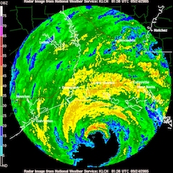 |
| Radar image of Hurricane Rita approaching landfall along the Texas-Louisiana border in September 2005. Image: NOAA Photo Library |
There’s a chance an El Niño could develop by late summer 2017, affecting the hurricane situation. One current theory holds that El Niño years have lower hurricane risk because they create greater wind shear conditions in the part of the Atlantic where hurricanes form.
A good source for tracking El Niño is NOAA’s Climate Prediction Center. It provides outlooks as much as 13 months ahead, including both hurricane and ENSO forecasts.
The Landfall. Atlantic hurricanes can make landfall anywhere in a wide swath of the United States that includes the Atlantic coast and the Gulf coast. And be warned: Hurricanes can drop huge volumes of rain on multiple states as they move inland. The resulting flood damage can be as bad as wind damage on the coast.
Along the coast, storm surges are as much a threat as the actual hurricane winds. NOAA offers predictive maps for this. The science news organization Climate Central also offers a tool for looking at storm surges in the context of sea-level rise expected from climate change.
The Path. The track of any hurricane matters. Though it may be hard to predict, NOAA is pretty good at this. The place to go for the best immediate information is NOAA’s National Hurricane Center. It offers updated maps that track the expected paths of hurricanes and tropical storms in many sophisticated ways. While much of the info you want is on their website, they have an effective and helpful press operation.
Staying Safe. Before the disaster is upon you, you can serve your audience by telling them more about hurricane preparedness. Besides the National Hurricane Center, one good source of information is the Federal Emergency Management Agency. Preparedness can include things like emergency information, home construction, oil and propane tanks, water wells, insurance, supplies, evacuation planning, etc.
And as a journalist, you may want to pack a go-bag. And have a plan for how you will file or publish when the lights go out and the water is rising.
* From the weekly news magazine SEJournal Online, Vol. 2, No. 22. Content from each new issue of SEJournal Online is available to the public via the SEJournal Online main page. Subscribe to the e-newsletter here. And see past issues of the SEJournal archived here.
SEJ Publication Types:
Topics on the Beat:
Region:
Visibility:

