


SEJournal Online is the digital news magazine of the Society of Environmental Journalists. Learn more about SEJournal Online, including submission, subscription and advertising information.
March 27, 2024
 |
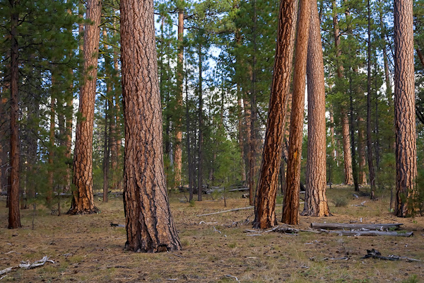 |
| A stand of old-growth ponderosa pine in the Fremont-Winema National Forest in southern Oregon. Photo: U.S. Forest Service - Pacific Northwest Region via Flickr (public domain). |
Reporter’s Toolbox: Finding Your Way Through the Forest of Forest Data
By Joseph A. Davis
OK, we’ll admit it: We’re lost in the woods. That is, the large, dense forest of data from the U.S. Forest Service.
Of course, it is a boon to environmental journalists that there is so much open data available and so many ways to get it. So here’s a compass to help guide you. Just watch for poison ivy.
If you live near a national forest,
you may know how many
environmental stories
can be found in them.
If you live near a national forest, you may know how many environmental stories can be found in them. Timber sales. Disease. Fires. Wildlife habitat. Fisheries. Hunting. Grazing. Climate impacts. And more.
We’ve talked about Forest Service data in the Toolbox before (see the editor’s note below). There’s so much data because there’s so much land (193 million acres, not all of it forest) in the National Forest System. And not all of that land is stands of trees — some is rangeland, scrubland, grassland, etc.
We would start by pointing you toward the FSGeodata Clearinghouse. But there’s a lot more. In addition to that clearinghouse, other National Forest data portals are essential. For example, there’s the Forest Service’s Geospatial Data Discovery site.
Most important is the page where you can “Download National Datasets.” Another “single point of access” is the Forest Service Enterprise Data page.
Where the data comes from
Most of the data in the above datasets actually comes from the Forest Service itself.
As it manages the forests for many uses (under the “multiple use” doctrine that governs its lands), the agency collects data, typically from its own personnel. We judge data from those sources to be as reliable as any you will find about forests.
But some of it comes from other agencies, federal agencies like the U.S. Geological Survey or the Bureau of Land Management.
How to use the data smartly
What makes much of this data useful is how it is organized and collected according to typical subject areas. The web presentation helps you index it according to subject area. Here is a partial list of examples.
- Trails: Some forest areas have improved and marked trails for hiking or other recreation.
- Wildfires: The Forest Service has data about wildfire risk and post-fire conditions, for starters.
- Tree species: Find info and data here describing forest type and structure.
- Insects and disease: As forests change with climate heating, these factors can harm whole ecosystems.
- Topography: Data here is in map form, useful for hiking or timber evaluations.
- Ownership and boundaries: Resources include inholdings and forest borders.
- Roads: Included here is info about which roads are closed and which are open.
- Recreational opportunities: Some forests have recreation sites, ranging from beaches to campgrounds.
- Logging and timber sales: Information of huge interest to loggers and those who report on them.
- Wilderness: Many wilderness areas and wild and scenic rivers are within national forests.
There are many more subject areas. But frankly, the Forest Service search engines and subject pages do not always navigate easily to something of interest. We don’t know if this is always true. Try Google instead and it may work better.
As usual, we caution you that the data alone will not make your story. But since it is often nationwide data, it may help you illuminate nationwide forest policies. Do the human and shoe-leather reporting, and groundtruth everything. Walk in the woods. Talk to foresters, loggers, canoe paddlers and local environmental groups.
[Editor’s Note: For more Toolboxes on forest data, check out our reports on a forest inventory and analysis program and a federal land manager environmental database, as well as a writeup about data on potential forest wildfire hazards. Get more via a forest search page, plus for further insight on forests and fire, check out our Topic on the Beat page on wildfire, which has top SEJournal stories and recent headlines.]
Joseph A. Davis is a freelance writer/editor in Washington, D.C. who has been writing about the environment since 1976. He writes SEJournal Online's TipSheet, Reporter's Toolbox and Issue Backgrounder, and curates SEJ's weekday news headlines service EJToday and @EJTodayNews. Davis also directs SEJ's Freedom of Information Project and writes the WatchDog opinion column.
* From the weekly news magazine SEJournal Online, Vol. 9, No. 13. Content from each new issue of SEJournal Online is available to the public via the SEJournal Online main page. Subscribe to the e-newsletter here. And see past issues of the SEJournal archived here.
SEJ Publication Types:
Topics on the Beat:
Region:
Visibility:

